2022 MCAD Capstone Project


hero image depicting a nighttime landscape with a lit up tent

I’ve always been most joyful and courageous when outdoors. It allows me to shed distractions, get closer to myself, and the version of myself I want to be. In my adult life I’ve come to love hiking and backpacking, spending even more time learning from the outdoors. Things like starting fires, filtering water, and other tasks of self sufficiency and interaction with the natural environment have taught me I am more capable than I realize. It is also an opportunity to shed technology and its distractions, and become comfortable with silence. Being outdoors with others has brought me closer in my relationships as well. It’s important to me that the outdoors plays a continual and increasing role in my life.

group of women wearing backpacks and in hiking gear
Friends and I on a backpacking trip spring 2022, Ottawa National Forest
marni with her father outdoors
My dad and I on a hike in Grand Marais, winter 2022
chicken of the woods mushroom
Possibly the most exciting thing you can find in the woods.

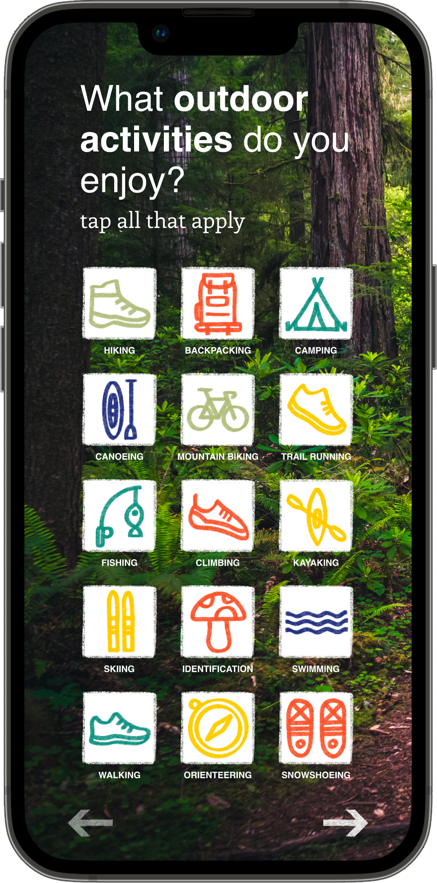
A need for greater preparedness and confidence on the trail:


In our Experimental Interaction class this past Spring, we were tasked to come up with a ‘future interaction’ to solve an existing problem. The future part meant that the interactive solution we came up with didn’t technically have to ‘work’ or be 100% technologically possible. It was about imagining what could be possible.

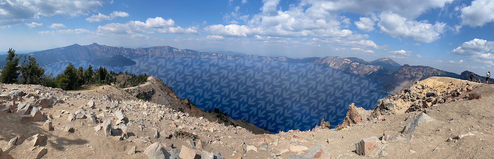
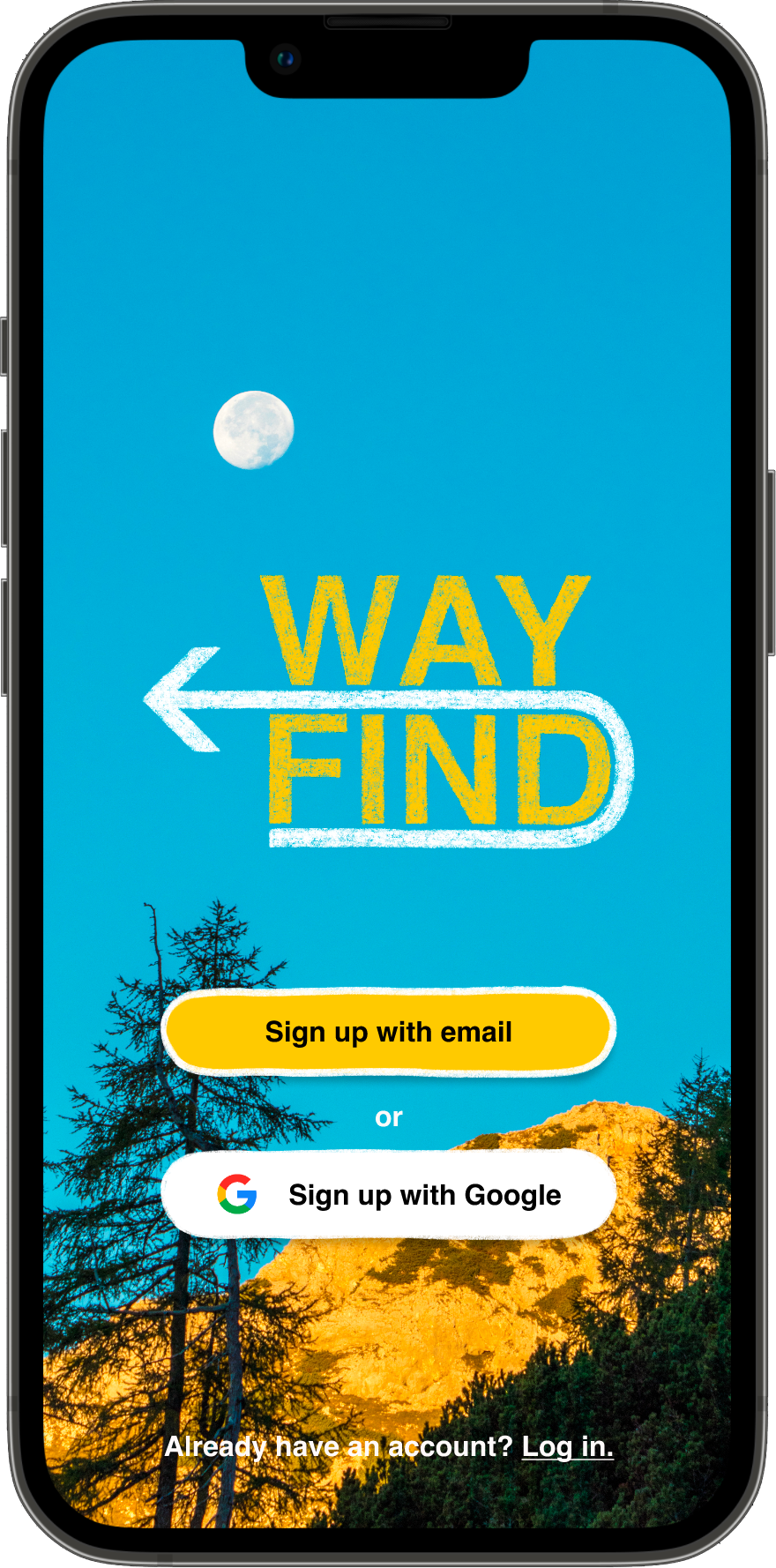
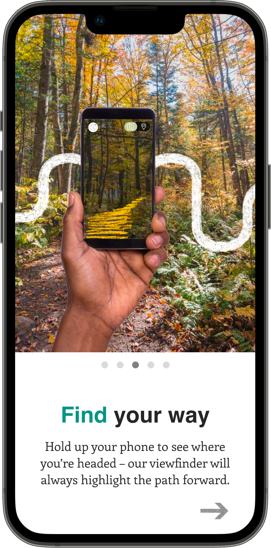
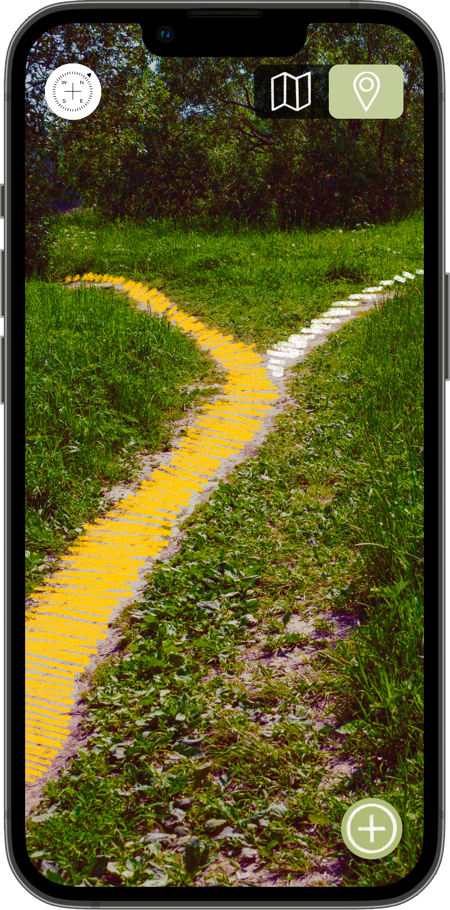
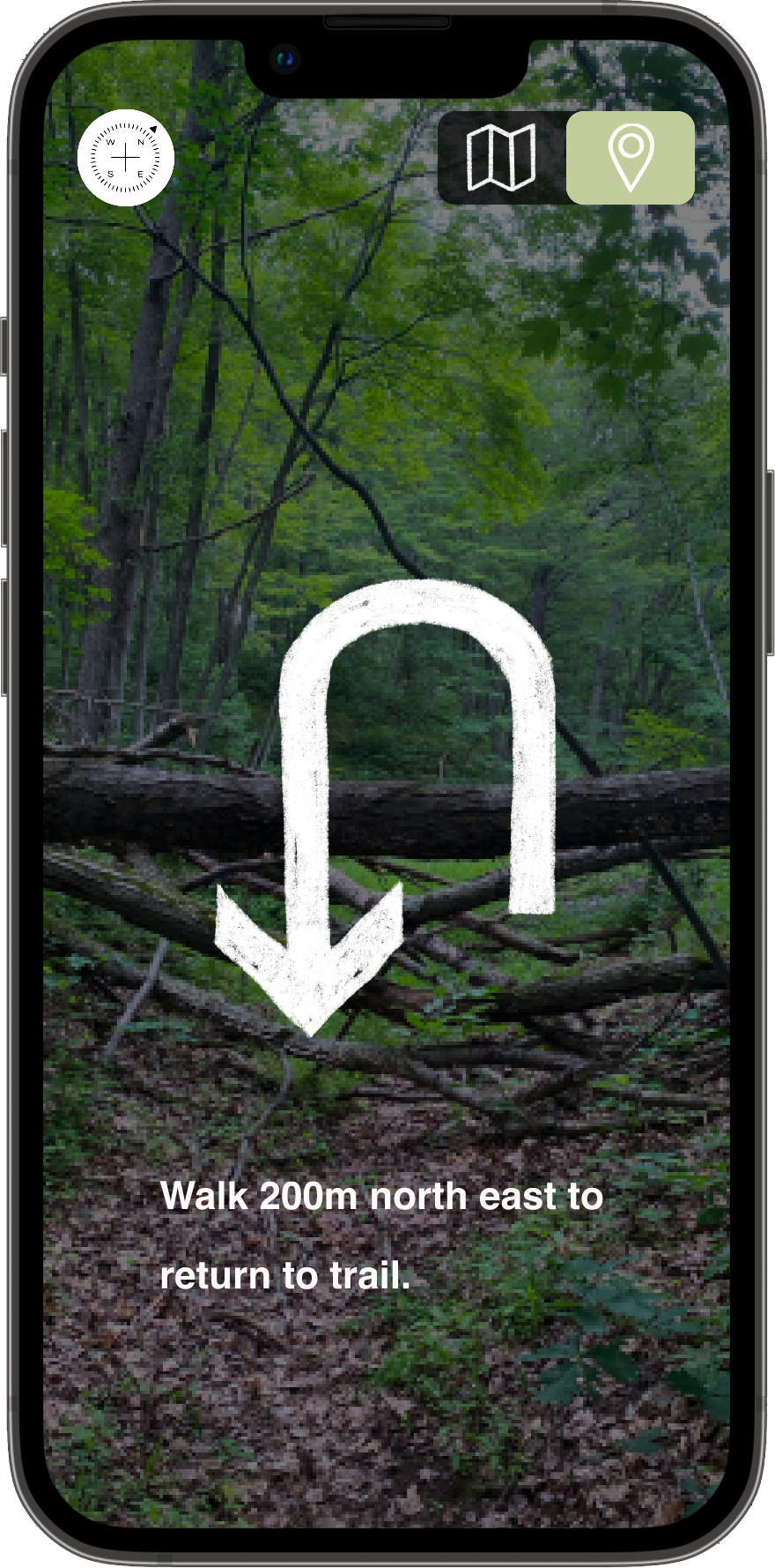
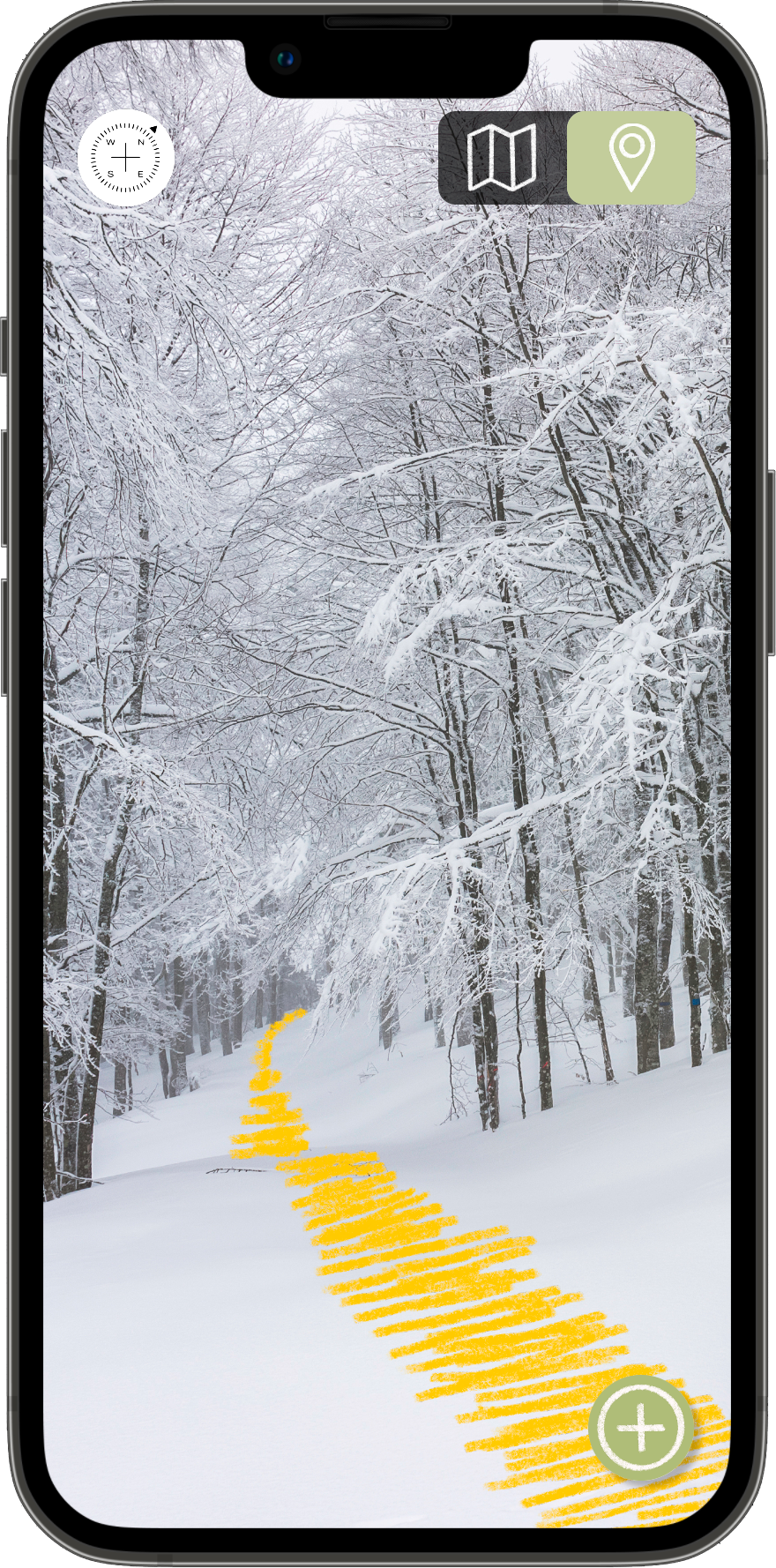
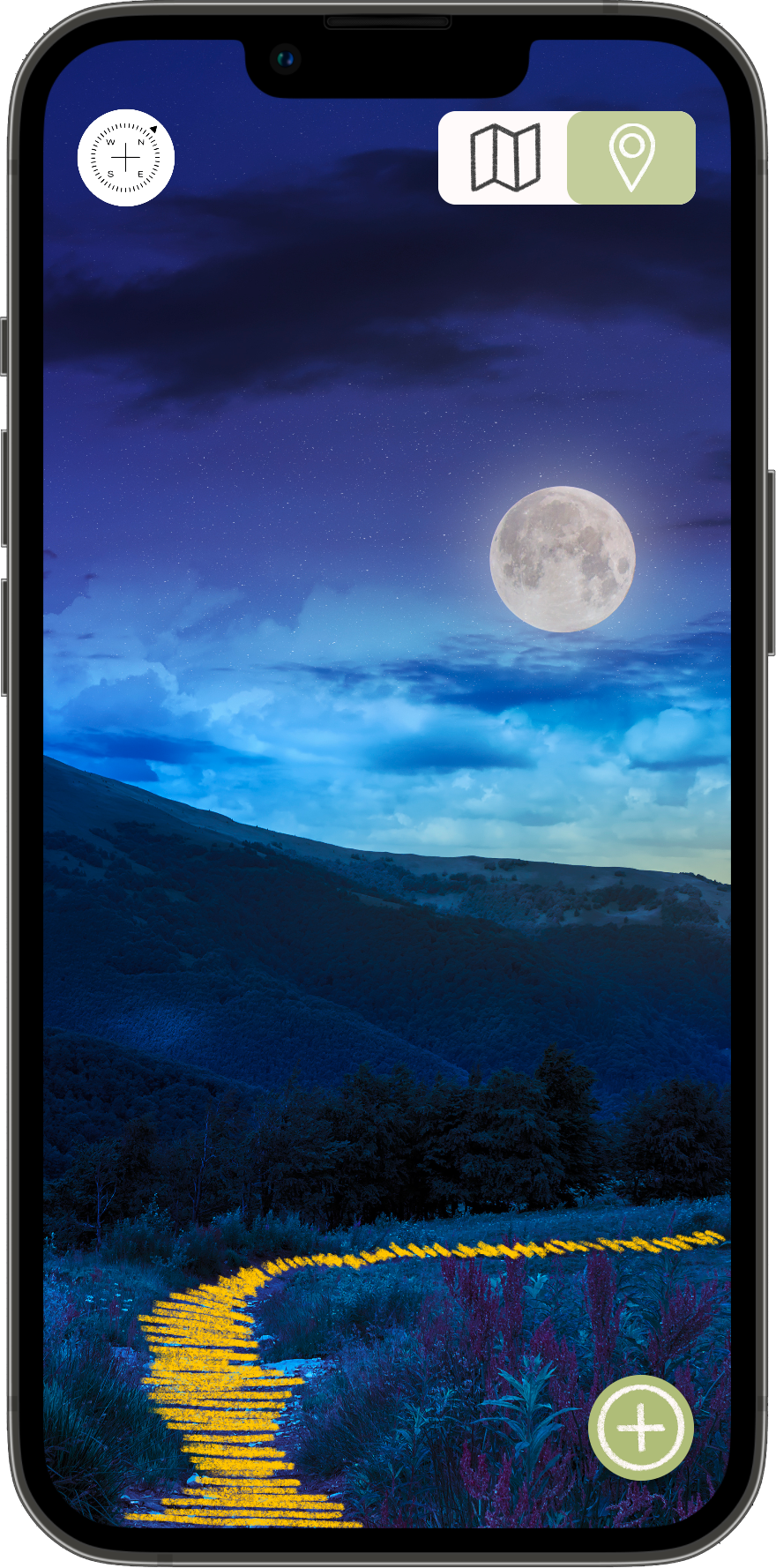
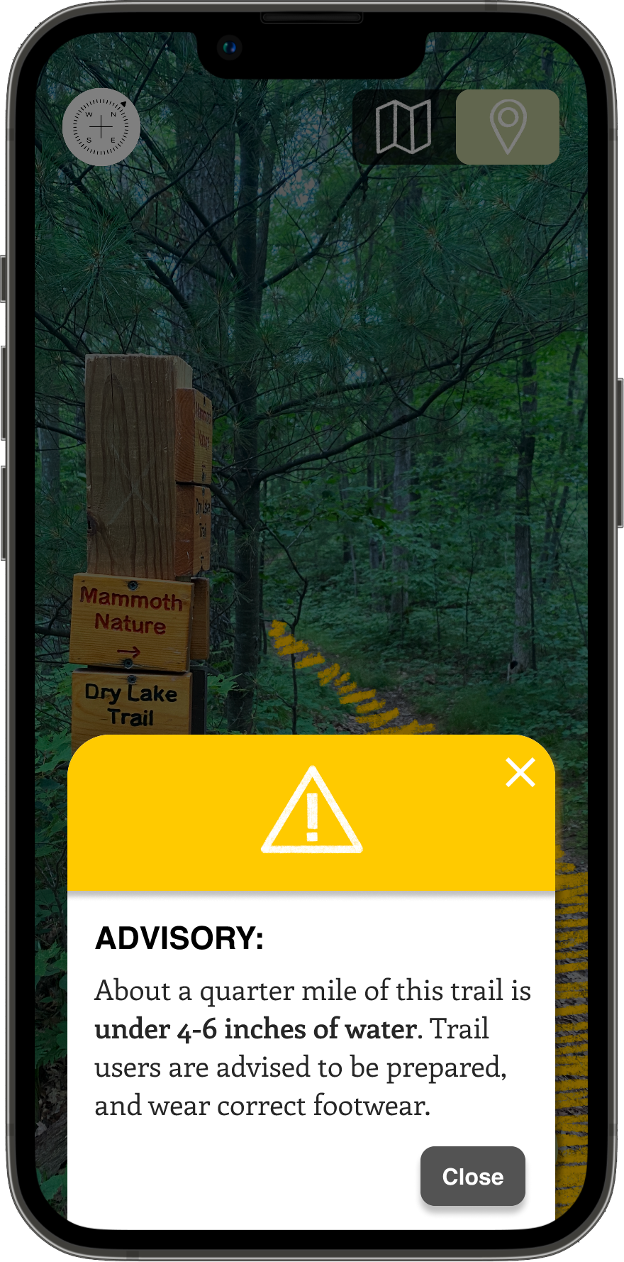
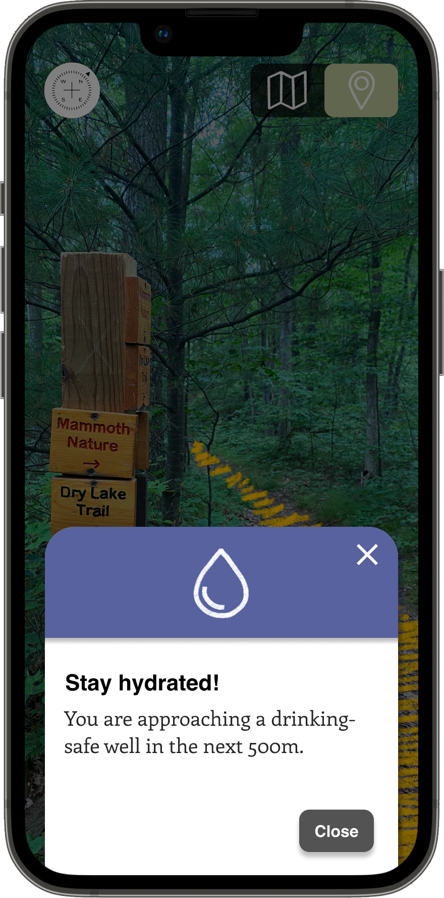
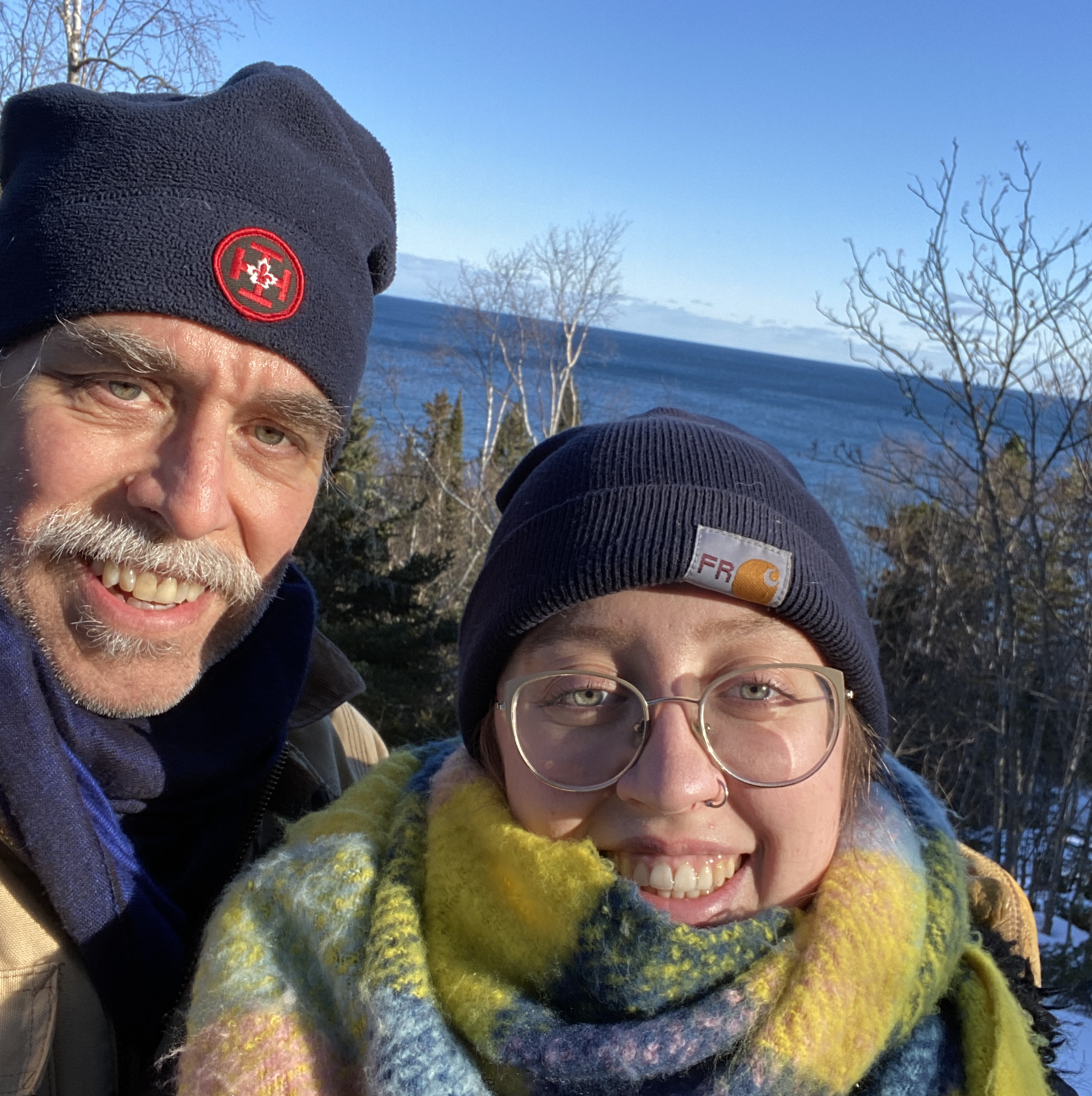
I was thinking about what I wanted to do for this project when my dad and I took a weekend trip to Grand Marais, MN at the end of March. On one of our days, we went for a hike on the shores of Lake Superior. It had just snowed, and much of the ground was covered. Most of the trail had been made clear by other hiker’s footprints, but in a few instances, it took us several minutes to piece together where the continuation of the trail was. We were never truly worried, as we had the Lake as a reference point, and could always retrace our tracks, but it could have been more difficult in a different scenario, and this led to an idea - what if difficulty seeing a trail in ‘real life’ could be avoided? Could a digital trail, integrated with and overlaid on one’s real environment, using augmented reality, allow the trail to be ‘seen’ at any time and in any condition?

This was my personal motivation and jumping off point, but in order to see if there could be a broader use/need for this idea, I started with some research. One, I wanted to learn about what issues currently existed in the world of public lands and trail maintenance, and 2, if my idea might fit in the range of solutions to said issues.

Through reading a variety of literature, from government bills to news articles, I acquainted myself with a range of current issues existing on trails and in the outdoor industry in the US. There are a lot, and I wish I could solve them all. But, through my research, I came to the conclusion that there might be a place for a trail safety and preparedness app, and that it could specifically help to address two areas:

Practical

teal line for emphasis

The first I labeled as practical.

Across the U.S., public lands are facing problems. They're seeing huge surges in attendance, especially during the pandemic, while at the same time, federal and state funding to manage these lands has been steadily decreasing for decades, creating a growing trail maintenance backlog. For example, at the beginning of 2022, an estimated $21.8 billion in deferred maintenance costs existed across the National Park System. This means there is 21.8 billion needed in repairs and maintenance for things like trails, campgrounds, buildings, water, sewer, and electrical systems.

Additionally, National Park Service staff has shrunk by 14% over the last decade, primarily due to funding cuts. Total visitation to all National Park properties has increased by 20% during the same period. These trends are true for land managed by other federal and state agencies, including state DNR’s, the Forest Service and the Bureau of Land Management.

This is also a climate change issue. Large chunks of budgets have been shifted to pay for wildfires in the West. Since 2000, for instance, the portion of the Forest Service’s total budget dedicated to wildfires has grown from less than 20 percent to more than 50 percent. With these climate emergencies becoming increasingly common, this problem isn’t going away anytime soon.

Funding cuts and increased needs have placed great stress on operations, infrastructure, and staff. A lack of preparedness from newcomers has driven up search and rescue costs, as well as staff and ranger time, taking resources from other areas. Infrastructure can be outdated and sometimes unsafe. Even something as simple as emptying trash or cleaning bathrooms can become unmanageable when resources are down and visitors are up. Staffing for visitor centers is difficult when staff are needed elsewhere, which leads to even greater unpreparedness. You can see how this might be a never ending cycle. This recent surge in visitors has collided with the already existing problems on public lands, including years of underinvestment, creating a kind of perfect storm.

These issues and their potential consequences such as weather, or time of day, made me think there could be a place for my project. There is a need for greater preparedness and education on the physical trail, whether it be the concern of getting lost, the need to be safe on poorly maintained trails, selecting the right hike for your needs and abilities, what to do when encountering certain animals or plants, or knowing about weather events that could interrupt a hike for the worse.

Park staff say a lack of preparedness, particularly among newcomers who may underestimate the extremes of these wild places, has driven up search and rescue costs and monopolized ranger time."

– Annette McGivney, The Guardian

There are these dramatic increases in recreational uses of public lands, and at the same time dramatic declines in recreational budgets."

– Megan Lawson, Headwaters Economics via NPR News

Perceptual

teal line for emphasis

The second issue I considered and researched was less to do with the physical realities of trails, but the perception of outdoor experiences.

In my research, I found a talked-about difference between people who grew up with outdoor experiences, and people who did not. There are many reasons that people may not have had the outdoor experiences that others have. Some cultures don’t engage with the outdoors as much as others. Maybe they live in an urban area with less access to natural spaces. Perhaps they don’t know what to expect or how to prepare. Perhaps they have fears concerning safety and security in the outdoors linked to racism or ableism. I read about the ‘Adventure’, or ‘Nature Gap’, which describes how African-Americans and other racial minorities have been excluded from environmental and adventure narratives, and are far less likely to engage in nature-based outdoor activities, with historic discrimination being a large underlying factor. According to a 2015 National Park Service report, only 20% of domestic national park visitors were people of color despite the fact they make up 40% of the US population.

For people who grow up thinking and feeling that the outdoors are not for them - a piece that may be missing is feeling confident and prepared to interact with a natural environment.

This project does not purport to solve the discriminatory and racist underpinnings of America that have led to barriers of access and fears of the outdoors. These fears should be taken seriously, and might never be unfounded or completely allayed. But, supporting the novice out-doorsperson is one piece in that direction. There are many programs and organizations created for this purpose; outdoors camps for urban or low-income kids, for example, or hiking affinity groups like Black People Who Hike or Black Girls Trekkin, organizations that empower, educate and reengage black people with the outdoors. This project could have a place in these missions. By helping the new or inexperienced hiker know what to expect, and providing information they may not have, it could provide assurance by making the unknown, known, and increase their confidence in their ability to get outdoors.

While Pinchot and Muir explored, articulated, and disseminated conservation and preservation ideologies, legislation was being enacted to limit both movement and accessibility for African Americans

– Carolyn Finney, Black Faces, White Spaces: Reimagining the Relationship of African Americans to the Great Outdoors

If you are new to the world of outdoor life, it can be an intimidating and overwhelming process,” said Mrs. Staples. “We don’t want that to deter people from our community from experiencing some of the greatest national treasures.”

– Lauren Sloss, The New York Times

landscape panoramic photo of crater lake national park

Providing Assurance, Building Confidence


These two areas of preparedness and safety - the practical concern of maintenance and funding, and the perceptual concern of familiarity and experience, were areas that I thought my project idea could address. It could provide assurance, and build confidence both in and on the trail. Thus, my project was conceived:

Wayfind is a wayfinding service and trail app that provides a safe and immersive outdoor experience, designed to assist hikers in gaining confidence in and access to natural spaces.

mockup of brand book cover

The core component of my project is a 32 page brand guide. To inform its content, I determined Wayfind’s mission, vision, and brand principles. I started by determining how I thought Wayfind might provide some solutions to issues of safety, empowerment, and access, and what mission and vision would drive the brand and service. I also determined Wayfind's brand principles and values.


Mission

green line

To provide safe and immersive outdoor experiences for communities of hikers around the world.


Vision

green line

To be an empowering connector between existing and potential outdoor enthusiasts and the experiences they want to have.


blue arrow
Brand Principles

The brand principles, once defined, were a way to start making informed decisions about the visual style and brand of Wayfind. It also informed how to talk about the brand.

Safety is our priority

Everything we do puts the safety of our hikers at the forefront. It might not be the sexiest priority, but we can say with confidence that leading with a passion for the well-being of our hikers and their trail experience is what sets us apart as trustworthy, dependable, and authentic. Safety doesn’t have to be synonymous with boring or lacking in adventure – in fact, quite the opposite.

...so that experience is yours

We worry about safety so that the hiker can move with confidence. Our work puts the mind at ease, inviting a calm, organic, immersive experience. By putting the hiker first, and focusing on their outdoor experience, we encourage the hiker to do the same for themselves.

We are especially eager to emphasize this for first-time trail users and outdoorspeople. The trail can be a scary unknown, and by making it safer and more known, we are intentionally welcoming more people to it.

Less is more

Slowing down can be a good thing. By keeping things simple and shedding distractions, we can enhance the trail experience for everyone. Our work shouldn’t steal attention or distract; it is what makes the inspiring and the immersive possible, through minimally invasive, unassuming support.

All of the benefits of analog are present (lo-fi, simple, easy) while providing important safety features of the digital age. Our brand should reflect as an alternative to our screen-centric, chaotic lives.

The trail brings us closer together

We are never closer to our fellow humans than when we climb a mountin, canoe across a lake, or sit around a campfire together. Emphasizing our ability to strengthen these relationships, and build community, is our secret weapon. We should take every opportunity, both in our content and our design, to remind hikers of this bond. At the end of the day, Wayfind is about facilitating and inspiring connection; it is the nexus between hikers and what they hope to find outdoors.

The trail is for everyone

We’re not just saying it – we mean it. We’re centering all hikers, of all abilities. We’re approachable, unpretentious, and we’re demonstrating a daily commitment to encouraging and supporting new and first-time users. We keep things easy to use, without jargon, and with a healthy dose of humility.

Competition and reaching the finish line have their place, but part of our focus on the hiker means no gatekeeping of outdoor activities or communities. All are invited.


Next, guided by Wayfind's brand values, I built out the visual brand and style. On one hand, it was important that Wayfind's brand clearly communicated our expertise – security, capable technologies, and trustworthiness were paramount. But, it shouldn't be cold or pretentious or exclusive. I worked to find the balance: Warm but not informal. Clear but not clinical. Excited yet calm. Serious when need be, but celebratory of the everyday joys in life. The resulting brand guide worked to find this balance.

Above all, I wanted the Wayfind brand to be genuine, human, and clear in our care for our relationship to both current and future hikers.

mockup of mission pages mockup of voice and tone pages mockup of logo pages

Wayfind’s logotype and logomark are meant to inspire a nexus of passion, trust, and belonging. It is active, with the arrow as a guide along the trail. This guiding arrow motif is repeated through much of Wayfind’s branding. The texture adds an organic, fun juxtaposition to the use of Helvetica as a classic wayfinding typeface. There are three approved colors, to remain consistent and calm.

mockup of logo use pages mockup of color pages

Wayfind’s color palette is meant to reflect both a calm, collective experience, and a bright and bold individualism. Each color can be used at varying tints, and the green with some additional shades, though it was important to me that the green shades were used sparingly. Too much, and the resulting olive tone could create a muddy, outdated feel. I wanted our use of colors to feel light, clean, and simple. I also added guidelines for contrast ratios, as it’s important that everything is readable in Wayfind’s digital work.

mockup of typeface pages

This was again an opportunity to find the balance between expertise and authenticity. Helvetica’s clean, ubiquitous nature, synonymous with reliable transportation services and signage, paired with the softer flourishes of Enriqueta, made for a timeless combination that communicated both reliability and personality, while still being legible and accessible.


I also created a set of custom icons. This was important to me, as I wanted a way to visually communicate repetitive concepts in an interesting way. They are simple and neutral, using an overall consistent stroke weight on the same pixel grid, while maintaining personality through texture, micro stroke variations, and color. The icons are meant to be fun and informative.

set of 48 icons representing a variety of outdoor activities or amenities, plus some basic ui and systems icons, multicolored

Mobile prototype


Once I had the brand underway, I wanted to operationalize these ideas and assets that I had created - what did Wayfind look like as a service? Using Figma, I built a clickable prototype with workflows that answered: What does a hiker encounter on their first time opening and using the app, and, What does it look like when a user wants to hike a trail?

First I focused on a new user’s inaugural experience. This was important to me because of the emphasis I wanted to place on welcomingness and accessibility. I wanted the intro sequence to grab a user’s attention, make them feel welcome no matter their experience and motivation, and ultimately make them feel like downloading the app was a good idea. A user wouldn’t generally encounter this workflow again after logged in and acclimated.

gif demonstrating loader login screen second login screen example third login screen example

After these log-in screens is a question sequence, meant to communicate to the hiker that Wayfind cares about creating an experience that fits their needs, goals, and experience level. This data would then be used to populate suggested routes.

screen saying: tell us about yourself screen asking: how much hiking experience do you have, with options screen asking: what outdoor activities do you enjoy, with options screen asking: why do you hike, with options screen asking: what do you want to prioritize on your hikes, with options

Finally is a sequence intended to give a brief and simple introductory overview of what Wayfind might have to offer. Rather than a complex introduction to specific features and interfaces, I opted to pique the interest of the hiker, and let them know how Wayfind might engage them. This also serves as a good opportunity to introduce Wayfind’s voice and values.

intro screen 1 intro screen 2 intro screen 3 intro screen 4 intro screen 5

The next workflow answers what it looks like when a user wants to hike a trail.

gif demonstrating home screen and features

Home screen and default map/trail views, main menu and floating action button:Once the hiker is logged in, their default view is a map. This page toggles between map and trail views. Trail view shows the AR interactions and updates that occur when the hiker is on the trail. Other features are a compass, and a floating action button that opens to the main menu that features weather, sunset time, a search bar, the (similar to what you might find in Strava or AllTrails) ability to track a hike, and a safety/help button.

gif demonstrating search function process

Search function: Next, we have the search function, which supports a user who would like to research different hike possibilities, search trails in a certain state, city, or park, learn more about a specific trail, or just browse what’s in the area. As you can see, the robust filtering options mean that the hiker can specify exactly what they are looking for, such as how long of a hike, what type of route, and what amenities or recreational opportunities they would like to prioritize. For example I might want to find routes that are wheelchair accessible, kid friendly, and that have readily accessibly bathrooms. The hiker can also sort search results by different criteria, including ‘my preferences’, which references the questions asked at the start of the app.

gif demonstrating how to select a trail

Selecting, learning about, and beginning a hike: As mentioned, I hiked and used the Chippewa Moraine State rec area as the prototype example, and the Circle Trail specifically. Here, once searched, the hiker can learn details about the hike, such as permitting and parking, trail condition, hours, amenities, recreational activities, and more. They can also view user-sourced images and updates. The hiker has the option to select ‘start hike’, which prompts them to decide if they’d like to track/record their hike, and then illuminates the path forward once on the trail.

picture of crossroads with highlighted trail overlay mockup of directions back to trail mockup of trail highlighted/overlaid on snow mockup of trail highlighted in the dark

Usage scenarios: Once on the trail, the hiker has the ability to see the trail highlighted, using augmented reality, at all times. You can imagine how difficult it could be to see in certain circumstances, such as in the snow or at night. Another scenario might be approaching a junction - not knowing which path to necessarily take, and easily being able to toggle between options, and receive information about where each path goes. Here’s where Rod’s story comes into play, about hikers not realizing they were on the Ice Age Trail until it was too late. In this case, the hiker would get a notification when approaching a crossroads, and be given information about their options.

mockup of alarm alert example mockup of advisory alert example mockup of notification alert example

Alerts: Another part of Wayfind is its tiered alert system; color/shape coded by level of importance, the app will alert the hiker for various reasons, ranging from the innocuous to the very serious. Alarms are for imminent safety concerns, Advisories are for directional corrections and changes in trail, and notifications are non-threatening regulatory, trail, or amenity items. Included in the alert system is the ability to contact emergency personnel. This system is especially important in that it means that the hiker can trust the app to alert them of important items, and therefore their phone doesn’t have to be out to get the full benefits of the app. The phone, based upon the hiker’s set notification preferences, will send push and in-app notifications regarding things like trail quality, severe weather, when it’s time to head back before dark, veering off-trail, directions to get back to trail, when a junction is approaching, and more. This is an important feature that sets Wayfind apart from other apps. You can also view user-generated notifications as pins on the map. Which brings me to the final function:

gif demonstrating process of how to pin update

Pinning a user update: Something I thought important from the beginning was for updates to be added in real time. Due to what I had learned in my research about trail maintenance backlogs, I liked the idea of users helping keep the trail safe: the hiker is able to add updates in real time/location so when someone hikes afterward they see update notifications as needed. Some could be serious, like a rock fall or a bear in the area, but users can also use it to connect with each other. In this case, the hiker finds a cool-looking plant and wants to know what it is. Someone could comment on this update with an answer, and connect with them post-hike. You can also view these user updates pinned on the map. I intentionally didn’t include an obvous social aspect to the app, but this feature is based on being good stewards, connecting over a common experience, and keeping each other safe.

Through hiking, and this project, I’ve found my enthusiasm for the outdoors extends far beyond my own experiences, and that increasing empowerment for and access to outdoor experiences is something I’d like to work on further.

I look forward to seeing what else the trail can teach me, to better find out what I can do for the trail and the community of people on it.

Here's the brand guide:

Here's the app prototype in Figma: